
This section of 39th Street, like many Midtown blocks, was a quiet residential area in the early 1900s. The rising popularity of automobiles and the development of residential housing led to a major transformation in the 1920s as W. 39th Street became a commercial corridor. The story of the block from 39th to Valentine Road between Wyoming and Genessee is a common one for Kansas City, yet also unique.
A reader asked about the history of the attractive building at 1610 W. 39th Street, which is currently home to Smoke Burgers. This led me to research the entire block, from W. 39th Street to Valentine between Wyoming and Genessee. It’s a typical Midtown block; it started out completely residential, but as it grew, West 39thStreet changed into a commercial corridor. But also like every block in Midtown, it has a unique story.
Before 1900, Only One Home on this Volker Block
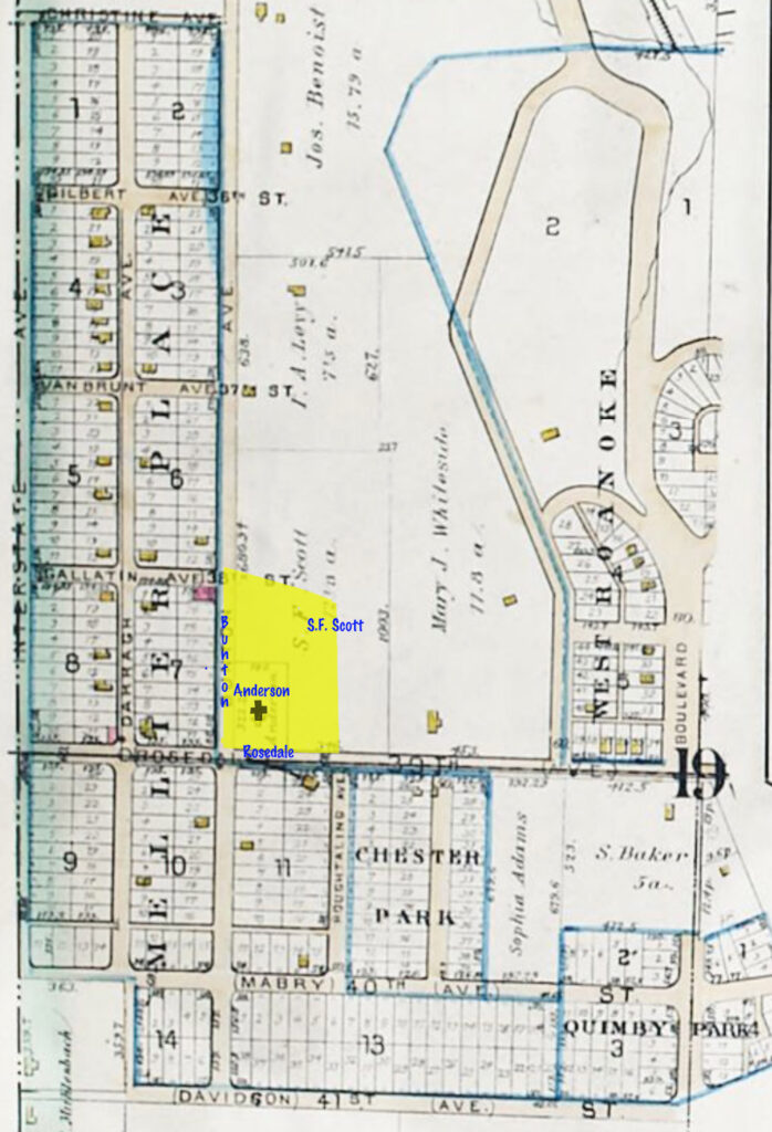
In 1891, W. 39th Street was called Rosedale, and Genessee was called Bunton. Wyoming Street and Valentine Road had not yet been created. The area in yellow shows the current boundaries of the block. Source: A Complete Set of Surveys and Plats of Properties of Kansas City, Mo.: Compiled and Drawn from the Official Records and Actual Surveys. Third Edition, G. M. Hopkins, C.E. 1891, courtesy Kansas City Public Library.
This block, as seen on a map from 1881, was slower to develop than others that surrounded it. While the map shows neatly-laid-out streets and a handful of homes on the blocks to the west, south and east that year, the area that is now we are considering (highlighted in yellow) contained only one home, that of Robert Anderson. Some of the rest of the block was owned by S.F. Scott.
West 39th Street was called Rosedale at this time, and Genessee was known as Bunton Avenue. Bunton’s name comes from the prolific development firm of Mellier, Darragh and Bunton, real estate investors who created the midtown subdivisions of Kenwood, Kenwood Annex, Mellier Place, Mellier Place Annex, Llewelyn Park, Murray Hill and Dickenson Place. Just to the west of Bunton Street, the firm named what is now Bell Street after Darragh, and the entire subdivision to the west took the name of William Mellier.
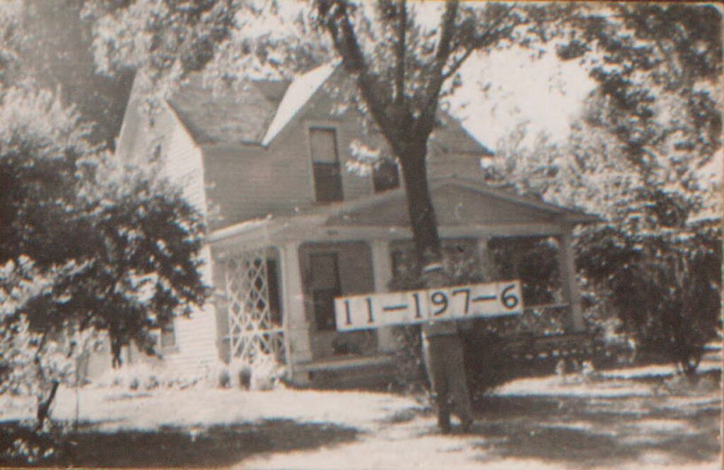
The block was prepared for development when Bonfils Heights was platted in 1898. It includes the entire area of today’s block. It takes its name from Fred Bonfils, a colorful character we have researched in another post. The first newspaper mention of development activity on the block came in 1902, when Bonfils sold lot 8, 3816 Wyoming, to Harriett E. Peak.

A sketch based on the 1940 photo of 3816 Wyoming, the first house to be built on the block after the area was platted. The Peaks came to Kansas City in 1858, James worked in the coal and feed business for twenty-five years, was a member of the Kansas militia during the Civil War and took part in the battle of Westport. They were members of the Roanoke Baptist Church. Mrs. Peak’s husband James was called a “pioneer of Eastern Kansas” when he died in 1912 at age 86.
1900-1910: The Block Fills In

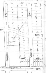
Like many Midtown blocks, development activity was rapid in the two decades after the turn of the century. (Source: Tuttle & Pike’s Atlas of Kansas City, Kansas, 1907.)

Development happened quickly in the first decade of the 20th century. By 1907, this map shows eight homes on the block. One prominent resident was A.E. Eubanks, an assistant police surgeon, whose duties included providing medical care for officers, responding to calls regarding injuries or deaths, and conducting forensic examinations. Another was livestock commission merchant R.W. Ryan, who, under Christian Science practice, died of typhoid without medical intervention.
W. 39th Street Becomes Commercial

When this photo was taken in 1950, W. 39th Street had become a commercial district, looking much as it does today. This photo shows the long commercial building stretching from Genessee to the east, which contained six storefronts. Historic photos courtesy Kansas City Public Library/Missouri Valley Special Collections.
As Midtown grew, the new residents and popular streetcar lines lead to the creation of commercial districts that served the new neighborhoods. The W. 39th Street corridor was transformed into a bustling business center. Around 1920, the residences along the street were razed to make way for commercial buildings, including a long row of storefronts at the corner of Genessee and W. 39th and a gas station at the corner of Wyoming.
Those storefronts would house a variety of ever-changing businesses, as they still do today. Records show that the businesses included restaurants, confectioners, beauty salons, and grocery stores, among others.

By the 1920s, more houses had filled up the block, and businesses serving the new neighbors had moved into the new commercial buildings along W. 39th Street. The businesses came and went as needs changed. This 1950 map shows a bowling alley, gas station, upholstery shop and paint store. 1950 Sanborn Fire Insurance Map.

In 1928, neighbors objected to having a public garage in their neighborhood, but the plan received city approval and was completed that year. The garage at 1610-12 W. 39th, would have various owners over the years, mostly serving as an auto repair shop. In 1957, it was listed in newspaper reports as the Roanoke Bowl, a family bowling center.

A six-plex apartment called the Newman was added to W. 39th Street in 1909. At some point, the former gas station on the corner of W. 39th and Genessee became a convenience store called Mr. Z’s.
The photos below show the buildings on the block as they looked in 1940.


Historic photos courtesy Kansas City Public Library/Missouri Valley Special Collections.