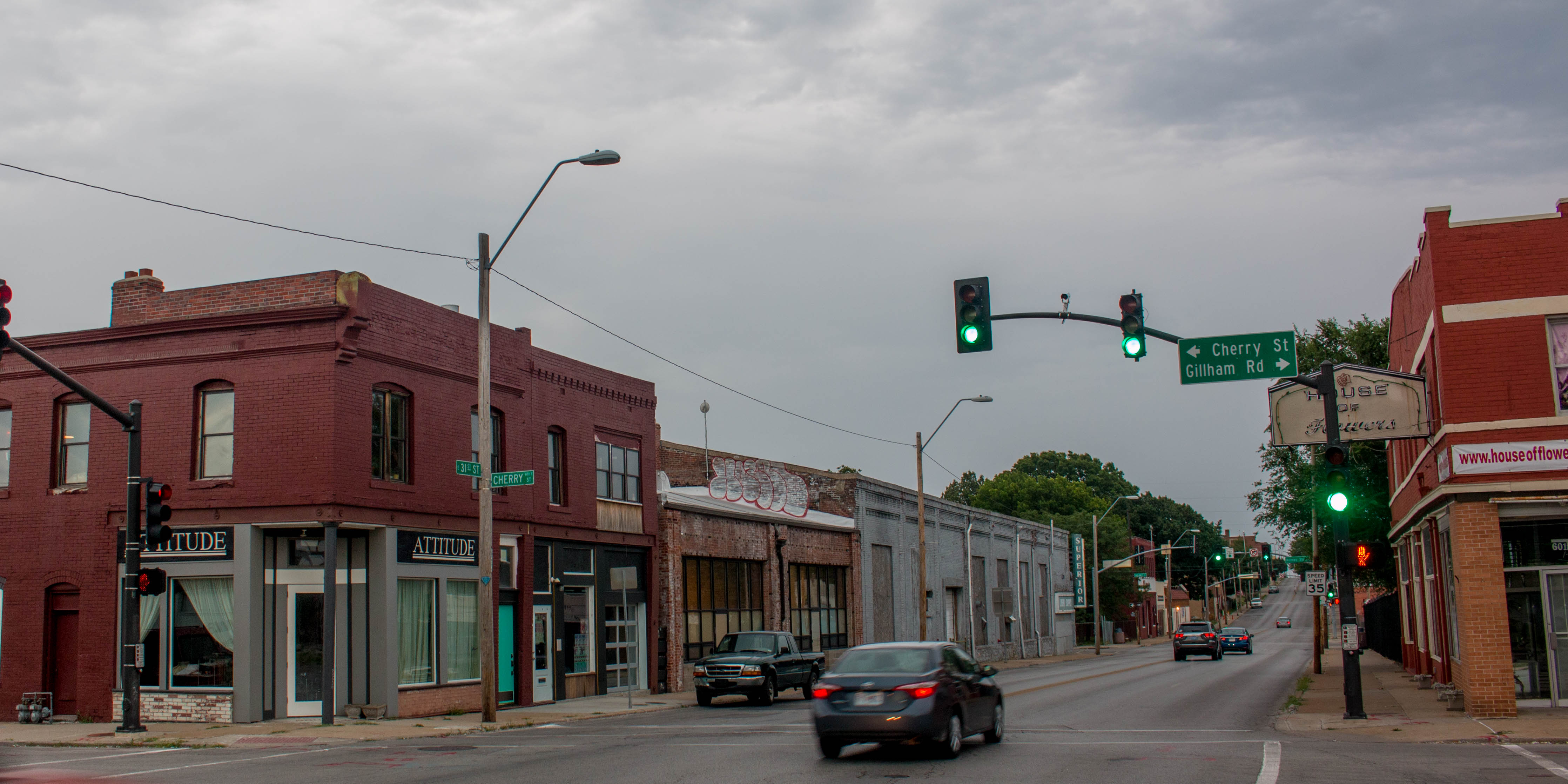
This block between 30th and 31st from Cherry to Holmes is in an area that is returning to life. Home to the Maker Village, the new Cherry Pit Collective, and the Superior Linen Company, it was once mainly residential but is almost completely commercial today.
As part of our Uncovering History Project, the Midtown KC Post is examining each block in Midtown. A set of 1940 tax assessment photos is available for many blocks.
This week, the block from 30th to 31st and from Cherry to Holmes is our focus.
A Residential Neighborhood in the Early 1900s
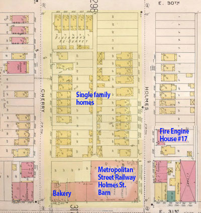
This Sanborn Fire Insurance map from 1896-1907 shows the block when it was mainly residential.
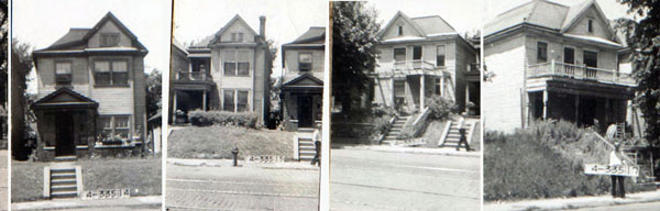
An early map shows this block packed with single-family homes built side-by-side along Holmes, Cherry, and 30th Streets. The homes are gone today, but photos of the Holmes Street section of homes from 1940 can offer a glimpse of what they once looked like (below).
The Metropolitan Street Railway Company’s Holmes Street barn dominated the corner of 31st and Holmes during this period. Just across Holmes stood fire station #17, which housed 14 men and five horses when the map was made.
Twelve frame homes were packed along Holmes Street, and a dozen mirrored them on Cherry. Another cluster spanned half of the block at Cherry and 30th Street.
By 1895, families rented or bought these “modern” frame homes. A newspaper ad for one in 1909 said it had an entrance room, parlor, dining room, kitchen, and pantry on the first floor and three bedrooms with good closets and a bathroom on the second floor.
Commercial buildings have since replaced the homes.
Changes On McGee Street
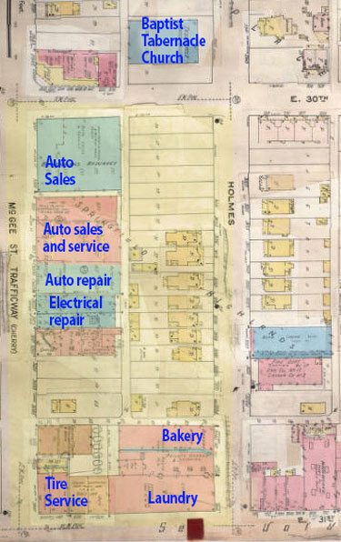
Map 1907-1950
As automobiles became more common, this area of Kansas City became an auto center. A Sanborn Fire Insurance map from 1907-1950 shows the change along Cherry (by then McGee Trafficway), where auto sales and services businesses had replaced nearly a dozen homes on the block.
More Businesses in the 1940s
By 1940, seven original houses were still standing on the block, but it was becoming increasingly commercial. The photos below show the non-residential buildings on the block was they looked that year.
Historic photos courtesy Kansas City Public Library/Missouri Valley Special Collections.
[slideshow_deploy id=’25678′]
In the 70’s was there an Italian restaurant on the NE corner of 31st or Linwood and Charlotte or Holmes?
Pingback: Cherry Pit Collective hopes to thrive in redeveloping 31st and Cherry area | Midtown KC Post
Pingback: Recap: Last week in Midtown Kansas City (June 26 – July 2) | Midtown KC Post
Wow! My folks owned our home at 811 E. 31st Terr. from 1957 to 1967. And, we went to church at Baptist Tabernacle, and my brother and I both went to school from K to 7 at Longfellow. From what I understand our narrow little street was originally called Glenerry Place. It’s great to see all these pictures of my old “hood”.
My folks and I moved to 3021 Forest in the summer of 54 when I was 8 and I lived there until 68. I went to Longfellow grade school. And then Westport High. Lots of memories from those years.
Small world! We lived at 811 E. 31st St. Terrace (between Charlotte and Campbell) from 1958 to 1967. I also went to Longfellow school and then Westport until the middle of 9th grade. I drive through that area once in a while and I’m amazed at all the changes. Our old house has been re-hated to the point that it almost looks new. They’ve also changed the name of 31st Terrace back to it’s original name of Glen Airy Place.
The Jones store that was on Troost WAS NOT located on the NE corner of Troost and Linwood as was stated in an article on this site. It was on the NW corner of Troost and 31st. I don’t know how this mistake started, but it needs to be corrected. I’ve even seen posts saying it was on the NE corner of Troost and 31st. The JC Penney store was on the NE corner of troost and 31st built after the Jones store. The building containing the Isis SW corner. And a muilti story buiding on the SE corner
I’m 71 and I grew up in my Grandparent’s home on the corner of 31st and Jarboe. My Godfather and his father before him worked at Allsman Cabinet Co. on 31st, just east of Gilliam on the north side of the street. If I remember correctly, there was a Velvet Freeze Ice Cream shop on the corner. When I was very young there was a roller skating building and not far east was a Jewish bakery that we always enjoyed.
James, I would be interested in what you may recall about Allsman Cabinet company… my phone is 620 200 2045 and I am a historian currently researching the life of George Allsman who owned that company, and his connection (1904-1964) to a church known as Troost Avenue Gospel Hall, which was part of a group known as the “open brethren”, a branch of the Plymouth Brethren.