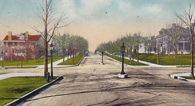
Today, this peaceful, tree-lined street doesn’t look much like it did when this scene was created around the turn of the 20th century. But it was one of the most celebrated streets in town, proudly featured in numerous postcards showing Kansas City’s new boulevard system.
The street is Armour Boulevard, back before it became a wide channel lined with high-rise apartment buildings in the 1920s.
For a while, Armour was the place to live for the rich and powerful.

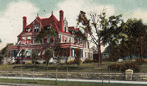
It began in 1893. Kirkland Armour, a member of the prominent family of meat packers, abandoned his mansion on Quality Hill downtown and moved south. Armour had the architectural firm of Van Brunt and Howe build him a French Chateau at the corner of what is now Armour and Warwick.
(Armour Boulevard was previously called Commonwealth Avenue, 35th Street, and South Boulevard before it finally got its current name. It was named after Kirk Armour’s family, which had been active in helping get the boulevard system developed).
Some well-off folks had already started moving south and were building homes in the area now known as Hyde Park. But when Kirk Armour’s began to rise on Armour Boulevard, even more well-off families followed him south from downtown.
Soon, Armour was lined with the imposing mansions you see in the photo above.
But what happened to them?
Transportation changes at the turn of the century changed the ambiance of Armour Boulevard. The street had once been the place to take a peaceful buggy drive. Still, it soon became clogged with automobiles, a major thoroughfare leading to the new suburbs developing further from the downtown business district.
In 1909, developers began responding to the need for housing by building apartments along Armour, and in 1917, they started building the luxury high-rise buildings that still stand on the boulevard.
The Armour home was demolished around 1930, and only a handful of the other mansion remain.
The bottom image is actually Linwood Boulevard – the St. Regis Hotel is visible in the center background. The Scottish Rite Temple, nor St. Vincent’s Church are still absent in the left-hand background from this pre-1924 image.
Thanks for pointing that out. The photo was mislabeled, but you’re absolutely right that is the St. Regis.
Even though most of the apartment buildings have been remodeled to their former glory, it is nice to still have some of the mansions left. MAC Properties remodeled this one and it is called the Victorian House on Armour. http://www.macapartments.com/kansas-city/victorian-house/photos/.