One of the major transformations in Midtown in the mid-1900s was the construction of Southwest Trafficway, a traffic artery meant to carry downtown business people and shoppers to their homes in the suburbs. Although less congested routes were clearly needed at the time, an unintended consequence was the transformation of Summit from a local business center to a speedway known as “the traffic way.”
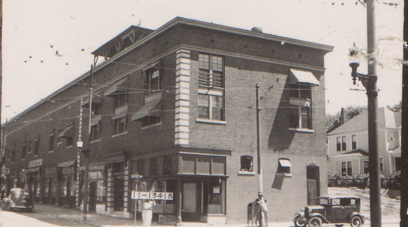
For example, the northeast corner of 39th and Summit drastically transformed. A photo from the 1940s (above) shows a long building that extended halfway up the block. The structure contained the Roanoke View Apartments, described as the “cleanest kitchenettes in Kansas City” in 1922 ads. Below, storefronts housed an ever-changing array of local businesses serving the surrounding neighborhood.
Construction of Southwest Trafficway began downtown, and by 1950, it had reached this area.
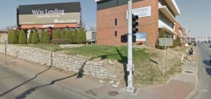
A recent photo shows the same corner today, transformed by the fast-moving traffic corridor, with the long building replaced by a billboards meant for passing commuters.
As part of our Uncovering History Project, the Midtown KC Post is examining each block in Midtown. A set of 1940 tax assessment photos is available for many blocks.
Today, the northeast corner of Summit Street and Thirty-ninth.
Local Businesses Served the Neighborhood
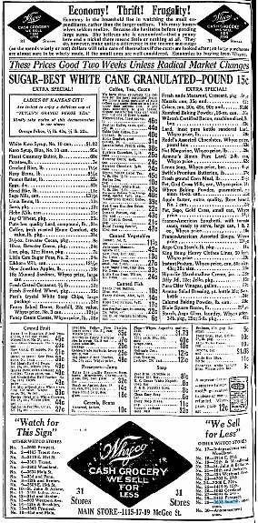
A grocery store at the corner of 39th and Summit served the neighborhood in 1920.
In the 1920s, the neighborhood around the corner was called Roanoke. It is now divided by Southwest Trafficway, with the west side still called the Roanoke neighborhood but east of the trafficway referred to as Valentine.
The apartment and commercial building appealed to residents because it was the site of a popular streetcar stop. One help-wanted ad for a café in the building called it a “good beer location,” and another described it as an “elegant neighborhood.” Philip Struening, described as a “kindly German shoemaker,” operated a shoe shop there for 22 years beginning in 1914. He lived nearby at 709 W. 34th Street. The “My Shoemaker” shop was known as a friendly hangout for neighbors.
As they stepped off the streetcars, local residents could take advantage of other services in the storefronts. Over the years, those included:
- 1910 – a shoe repair business and a bakery
- 1921 – “An exquisite display of dress material” offered by Mrs. Forrest
- 1923 – a wallpaper shop
- 1928 – a dry goods shop
- 1930-38 – several different grocery stores
- 1933 – a bookshop
- 1943 – a Lionel electric train repair shop
- 1945-47 – the Roanoke Bicycle Shop
Historic photos courtesy Kansas City Public Library/Missouri Valley Special Collections.
Interesting building in background on the right.