
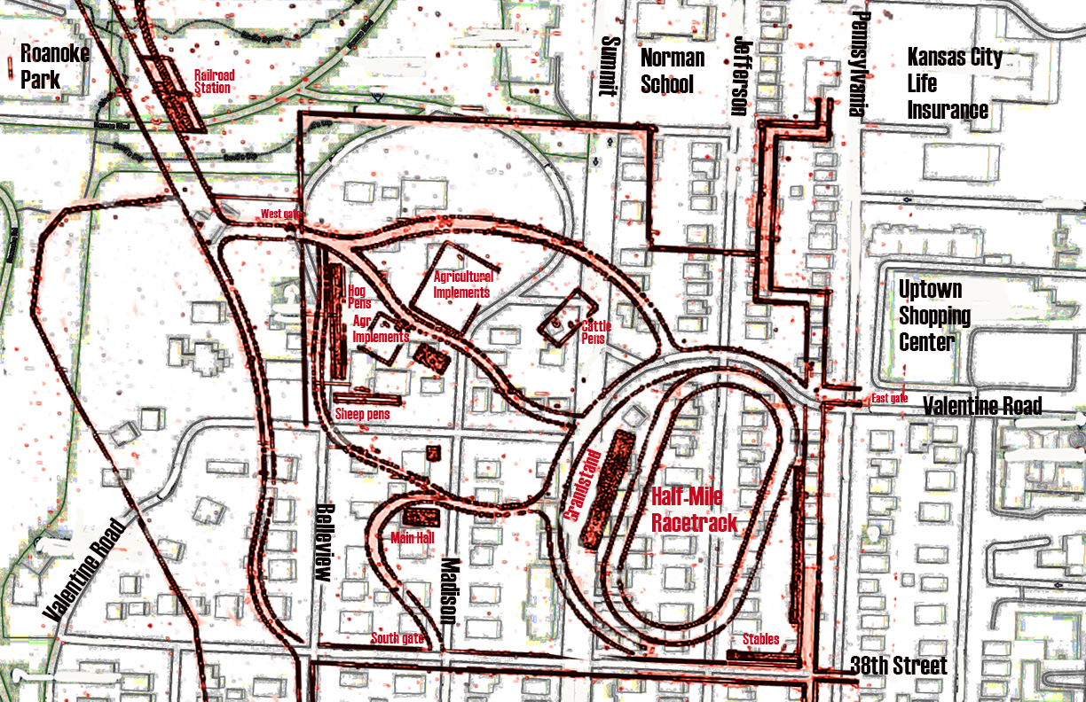
It has long been told – with little hard documentation – that the curve of Valentine Road follows the curve of a race track that once stood there. This map, with the racetrack and other fairground buildings overlaid on top of a current map, supports that theory. The grayed-our areas in the back are the current streets and houses of the current Valentine and Roanoke neighborhoods, while the red shows the racetrack, buildings and roads that made up the Inter-State Fairgrounds.
A popular fairground that lasted for only five years left a lasting mark on the development of Midtown. In the 1800s, fairs that showcased agriculture techniques and equipment and offered wildly-popular horse races, were held all over the United States. From 1882 to 1887, the Kansas City Inter-State Fairgrounds operated on land stretching from Thirty-eighth and Valentine between Pennsylvania Street and Roanoke Road.
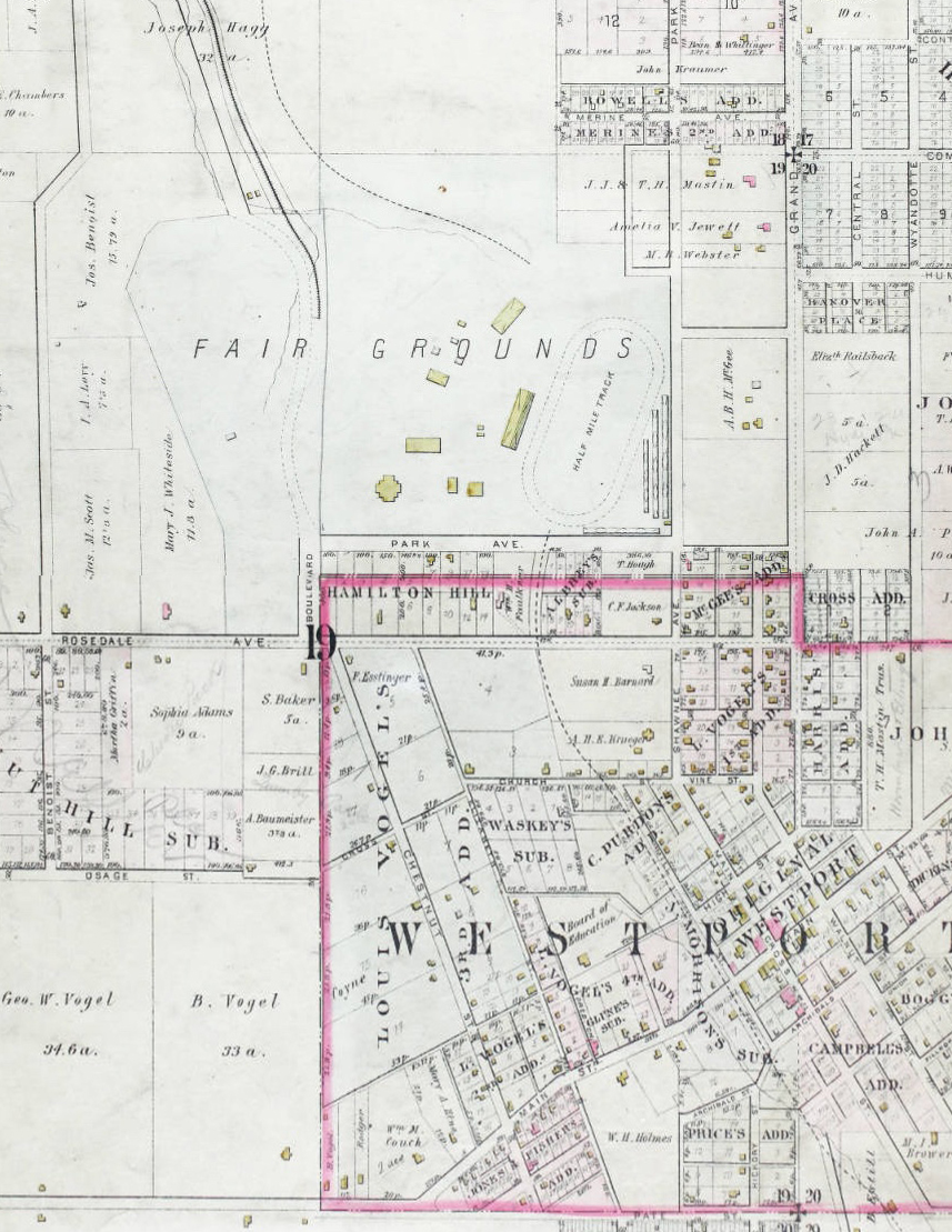
This 1886 map shows the fairground and the land on which A.B.H. McGee continued to live between 38th and Valentine from Broadway to Pennsylvania.
A group of investors bought up 133 acres of land and sold stock to fund the building of the fairgrounds. Most of the land had been part of the large tract owned by A.B.H. McGee, who reserved the land from the east side of Pennsylvania to Broadway, from Valentine to 38th, where his home stood. The fairground was just north of the limits of Westport and an hour south, by buggy, from Kansas City.
The fairground infrastructure grew over its few years of existence. The half-mile racetrack, which stretched from what is now Valentine Road south to 38th between the west side of Pennsylvania and Summit Streets. To the west of the fairground the Inter-State company built a three-story grandstand. The stables lined the edge of the fairground on 38thand Pennsylvania.
The annual autumn fair was a weeklong event. The fairground was also put to other uses such as patriotic celebrations and military drills.
By 1887, although the fair was gaining popularity, the stockholders decided to take advantage of a land boom that made the property worth fifteen times its purchase price. The entire site was sold and platted as the Roanoke subdivision, which includes parts of the Valentine and Roanoke neighborhoods. A new group organized and renamed the event the National Exposition, moving it to land between 12thand 15th Streets near Kansas Avenue.
Do you have memories or more details about this area of Midtown? Please share them with our readers. Would you like us to focus on your block next week? Send us an email.
Our book, Kansas City’s Historic Midtown Neighborhoods, is available now at local bookstores and on Amazon.com. Let us know if you want us to come to your neighborhood association or organization’s meeting to share what we’ve learned about Midtown neighborhood history and tell your members how they can help preserve Midtown history.
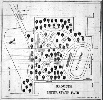
Behind the grandstand was a fine stand of old trees, and roads led visitors to various exhibit spaces.

Thank you so much for bringing this piece of history to our attention! Your research must take so many hours for each project. I only hope you realize how valuable all of your contributions are to people such as myself.
I’m sharing this article with previous Roanoke residents who may not be on your mailing list already.
With much appreciation,
Cathie
Thank you for your research! Higher resolution images of these and many other interesting maps of the Roanoke Park area can be viewed at https://www.facebook.com/pg/RoanokeParkKC/photos/?tab=album&album_id=359588114145470