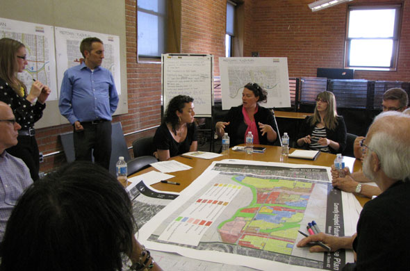
 Residents of the Midtown neighborhoods just north of Brush Creek had their chance to weigh in on the evolving Midtown-Plaza area plan on Tuesday. They expressed their support for retaining the land use and character of the Country Club Plaza, and talked about opportunities for neighborhood-friendly development along Troost.
The discussion came at the final sub-area meeting for the Midtown-Plaza area plan, which when completed will be a new set of city guidelines for land use, zoning, public improvements, transportation, housing and economic development.
Residents commented on transportation, urban design and land use issues for the area from 43rd Street to Brush Creek, from State Line Road to Paseo Boulevard.
One common theme through the discussion was that residents are happy with the current use and design of the Country Club Plaza, which they described as a shopping area surrounded by apartments. Numerous people said the “bowl concept” for the Plaza has led to high-quality development and should be retained.
A plan to build a large office building on the Plaza recently caused a major development fight. A group calling itself “Friends of the Plaza” organized to stop the development, and has been vocal in supporting the Plaza Urban Design & Development Plan.
“The dominant urban design concept of the Plaza area is the bowl concept, the notion of buildings increasing in height as they are placed on the gently sloping hills, rising from Brush Creek. The bowl concept emerged as the Plaza area developed in the 1920s and 30s with the low-rise buildings of the Country Club Plaza being surrounded by high-rise apartment buildings. This transition in building heights has been reinforced by office, hotel and high-rise residential development in the 1960s, 1970s and 1980s,” The Friends of the Plaza website says.
At Tuesday’s meeting, the planning team also released an analysis of the section of Midtown.
It said the area currently falls under 11 plans, including: the Westport Area Plan of 1972; the Oak Park South Plan of 1977; the South Central Area Plan of 1980; the Plaza Urban Design and Development Plan of 1989; the Troost Corridor Plan of 1998; the Brush Creek Land Use and Development Plan of 1998; the Main Street Corridor Land Use and Development Plan of 2003; the Troost Corridor Action Plan of 2003; the Plaza Westport Neighborhood Plan of 2004; the Main Street Streetscape Plan of 2008; and the Cultural Heritage District Plan of 2011. Other related planning efforts include: the Green Impact Zone; the Chamber of Commerce Urban Neighborhood Initiative; Creating Sustainable Places – Troost Corridor; the Manheim Park Development Strategy; Planning Sustainable Places – Cleaver II and Troost Redevelopment; Action Plan Sub-target area: Manheim Park; St. Luke’s Master Plan; Rockhurst Campus Master Plan; and UMKC Campus Master Plan.
Other key findings from the analysis:
- Brush Creek is a barrier to north/south movement through the study area
- Increased definition of the connections between destinations that would make them more accessible by foot or bicycle are necessary, including between the university campuses, south of Brush Creek, between the Plaza and the universities, and between the Plaza and Westport.
- Main Street is the most heavily traveled north/south route in the sub-area. Cleaver II Boulevard/47th Street east of Roanoke Bulevard and 43rd Street between State Line and Southwest Trafficway are the most traveled east/west streets.
- 43rd Street between Madison and J.C. Nichols Parkway and at Wyoming Street, as well as Cleaver II Boulevard between Main and Oak, between Rockhurst and Troost and between Tracy and Paseo Boulevard rate as congested.
- A decreasing population, housing units and lower median income has led to an increase in vacancies in the housing market. Development projects throughout the area have recently reversed this trend.
Details
Previous posts
- Midtown planning meetings raise questions about traffic and development
- In NW area of Midtown, concerns about traffic speed and development
- In NE area of Midtown, vacant property and changes brought on by redevelopment
- Public gives more input into developing Midtown-Plaza plan
- Packed room tells city what is good, could be better about Midtown
- Midtowners already weighing in online on Midtown/Plaza plan
- Residents invited to give input on Midtown/Plaza future
- Residents tell Midtown-Plaza planners why they live in Midtown
- What concerns do residents have about Midtown’s future?
- Midtown Plaza planning meeting, new info


Who’s talking